Reference


OpenAI's Answer
The boundary dispute between North and South Carolina has a long and complicated history, evolving over several centuries. Below are some key points in the evolution of this dispute:
-
Early Settlement and Division (1663-1729):
- Initially, Carolina was a single colony, granted by King Charles II to eight Lords Proprietors in 1663.
- Due to political, economic, and geographic differences, the province was increasingly difficult to govern as a single entity.
- By 1712, North and South Carolina were officially divided into two separate provinces.
- In 1729, both regions became royal colonies, establishing more distinct governance and boundaries.
-
Initial Surveys and Boundary Issues (1730-1815):
- Disputes began around 1720 regarding the exact placement of boundary lines, especially as settlers pushed westward.
- Boundary surveys were conducted, but they were often inconsistent and poorly documented due to the challenging terrain and lack of precise instruments.
- Over the years, multiple surveys attempted to resolve the boundary, leading to a series of adjustments and clarifications.
-
19th and 20th Century Adjustments:
- Continued settlement and development, coupled with better surveying technology, led to further refinements of the boundary.
- Jurisdictional disputes frequently arose, particularly in areas where the boundary affected local governance and resources.
- By the early 1900s, more accurate surveys using modern methods led to more significant corrections and re-establishments of the boundary.
-
Modern Efforts (1990s-Present):
- In the early 1990s, issues along the state boundary re-emerged, particularly regarding jurisdictional responsibilities in counties close to the boundary line.
- The South Carolina Geodetic Survey and the North Carolina Geodetic Survey collaborated to clarify and officially document the boundary line.
- These efforts were part of a larger program to resolve any remaining disputes and ensure consistent governance along the border.
Overall, the boundary dispute evolved from a loosely defined colonial boundary to a well-documented modern state line through centuries of negotiation, conflict, and technological advancements in surveying.
For a more detailed exploration, you can refer to:
- NCpedia on Carolina Becomes North and South Carolina
- The North Carolina - South Carolina Border Surveys (1730 to 1815)
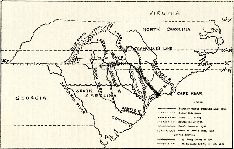
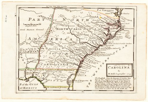
Here are some historical maps illustrating the boundary evolution:


Follow Up
Related
Why did the boundaries between North and South Carolina need clarification?
What role did surveyors play in fixing the Carolina state boundary issues?
What resources or institutions were involved in documenting the history of the Carolinas' boundaries
How did the state boundaries between North and South Carolina get officially resolved?